
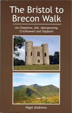
BRISTOL TO BRECON WALK
The Bristol to Brecon Walk is an 85 mile long-distance path. The route includes a wonderful variety of scenery including mountains, lovely valleys, historic towns and some lesser-known parts of south Wales.
The route starts from Blaise Castle and heads for the old Severn Bridge by way of Spaniorum Hill and Severn Beach. Once in Wales, the first day finishes at Chepstow Castle. The following day follows an intricate but scenically varied journey to Usk by way of Gray Hill and the Wentwood Forest. An easy start the next day follows the River Usk before heading west to one of the best walkers pubs in Wales and the Blorenge ridge. A beautiful descent leads to Abergavenny and the end of the day.
The climb of Sugar Loaf is the highlight of day four but its attractions don't end there. The route also ascends Table Mountain before easier and delightful walking leads to the next overnight stop at Crickhowell. Next morning the most varied day of the walk stays attractively at low-level in the morning before the afternoon climb of Tor y Foel (hopefully) gives panoramic views of the Brecon Beacons. This classic group of mountains is traversed during the final day's walk from Talybont to Brecon, culminating in the ascent of Pen y Fan, the high point of the walk.
The walk would make a wonderful and inexpensive week's holiday. It can also be enjoyed as a series of day walks or by creating circular walks using sections of the Bristol to Brecon route.
A book describing the route by its creator Nigel Andrews was published in 2008. Inevitably there have been changes to the route and its surroundings since then. As a result Nigel has decided to withdraw the book from sale. There is no realistic prospect of an updated book but we are exploring ways of providing information that will enable people to enjoy the walk in future,
You can now download a pdf file of the book including the latest updates.
The file you download will be a zip file from which you can extract the pdf file.
download the zip file You can also download a gpx file for the route which includes the following changes and updates.
Also“the Long Distance Walkers Association” has a very useful page on the Bristol to Brecon Walk which includes information about the walk together with a map of the route.
THANK YOU!
Thank you to the many people who have bought a copy of "The Bristol to Brecon Walk". I hope that you all enjoy the walk and that you spread the word about this new long-distance footpath. I have been pleased to receive very positive feedback about the walk one person who walked the whole route thought it was better than the West Highland Way. Thanks to those of you who have sent postcards to mark your completion of the walk. Please spread the word about the path so we can encourage people to come to Bristol to do its very own long-distance path.
BELOW ARE UPDATES FOR THOSE WHO OWN THE BOOK
ROUTE CHANGES AND UPDATED INFORMATION 14/05/21
Inevitably there have been changes to the route since the book was published in 2008. They are most prevalent on days 1 and 2 and they are set out in detail below with references to the paragraph in the original text. Days 3 to 6 have not materially changed as much of the route is through hill country. I cannot guarantee that that this is a full list of changes and I recommend that you take the appropriate OS maps with you.
DAY ONE
Severn Beach to Aust
Since the publication of the book this section has come up in the world and is now part of the England Coast Path. It has now reopened after a period of closure. (March 2024). It is likely to be closed again for flood prevention work and I am advised that alternative routes will be indicated on the ground when this happens.
The following section describes changes to the route in normal circumstances.
EASTER COMPTON CHURCH TO THE WESTERN APPROACH BUSINESS PARK Revised 2020
There are changes to the route from Easter Compton church for a variety of reasons, the main one being the construction of a new junction on the M49. The route has also been affected by the expansion of the Western Approach business park and a path now being blocked.
Please see page 20 paragraph 3. Do not enter the churchyard, other than to see it (recommended) or to visit Easter Compton, but instead turn left to keep the church on your right and follow the road. Shortly after it becomes a cycle path and it should be followed for about two-thirds of a mile. As you approach the embankment of the motorway junction look out for a non-standard blue sign indicating that walkers should turn right, and follow that recommendation.
The path follows the right-hand boundary of two fields before swinging left to continue along the field boundary. You soon cross a footbridge to continue in the same direction on the other side of a small watercourse. Continue to follow the same line keeping the stream on your left, crossing further bridges, one of which has seen considerably better days.
At the end of this section you will see a small bank in front of you and a view of a road bridge to its left. A kissing gate admits you to this bank which you climb to reach the road. This short section can be very overgrown in summer.
Turn left to cross the road bridge over the M49and continue to the roundabout at ST553835. Turn right to follow the directions in paragraph 2 of page 21.
The new route is not an aesthetic highlight of the walk but will quickly get you through an uninspiring section. There is so much to look forward to!
SEVERN WAY Revised 2016
The firing range to the north of New Passage (page 23) has gone and the welcome replacement is the Pilning Wetlands, a partially flooded area which attracts migrant and wintering birds.
Also on page 23, paragraph 4, the footpath alternative to the Severn Way is now in poor condition with awkward stiles and navigational difficulties. I recommend that walkers follow the Severn Way signs to walk along the road. This climbs and swings right and should be followed until a turning on the left indicates the way on to the Severn Bridge.
ARRIVAL IN CHEPSTOW AFTER CROSSING SEVERN BRIDGE Revised 2016
Not long after the publication of this book part of the footpath alongside the Wye inconsiderately joined the river. This section is now unsafe and is no longer a right of way. I recommend the following changes from page 25 paragraphs 3 and 4. Life is now made much easier as our route follows that of the Wales Coast Path. It is very well signposted and the Path’s logo is even inset to the pavements.
From the top of the road from the tunnel under the M48 (Caerwent Lane) turn right to follow another road for about 150 yards. Look for the Wales Coast Path logos in the pavement. Take the first available turning on your right (Tenby Lane) and continue for a further 50 yards to the football ground. Turn left and walk behind the goalposts and continue on the obvious path ahead.
The next section of the walk is subject to a path closure so do not turn right at the stile as previously advised. A sign with the caption “what, no coast?” explains the situation. Page 25 paragraph 4 should be ignored.
Continue on the same well-made path as you followed from the football ground and you will soon enter attractive woodland. Continue to follow the good path which eventually descends to a point to the left of a railway bridge,. By the way, you can still pass under the bridge for a view of the river and perhaps a sighting of one of those Wye-registered cars! The signposting points you up the climb to a suburban road mentioned in paragraph 4. This path is now metalled and way up is obvious.
You may now resume the route as described in the book, aided by the excellent Coast Path signage.
DAY TWO Revised 2016
There have been a number of changes to the route including the ascent of Gray Hill and a section of Wentwood Forest. I strongly advise you to carry both OL Explorer 14 and Explorer 152 to aid navigation.
The village shop in Shirenewton has now closed. Please make sure that you carry adequate provisions for the walk from Chepstow to Usk.
Page 32 paragraph 2
The cream house has been replaced by a new house. The road after this point becomes a rough track.
Page 32 paragraph 4
This field is now much easier to navigate. The fence on the left has gone and has been replaced by a wind turbine which you keep on your left. Go straight across the field towards a gate in the far boundary. Do not cross the gate but instead turn left and follow the field boundary downhill for 200 yards to reach the gate which admits you to the woodland.
Revised 2021
Page 32 paragraph 5. The original route is blocked at the gate described at paragraph 33 page 2. Do not continue to Cribau Mill. Immediately after crossing the stream on a humpbacked bridge take the signposted footpath on your left. Initially head half-left to pass through a gap. Now walk half-right into what soon becomes a much bigger field. Keep following the same line as you climb steeply towards a line of trees at the top. About half way along the top boundary of the field there is a gate. Pass through it to continue the ascent until you reach a stile which you climb. Turn right and follow the right-hand edge of the field to reach another stile. This leads you into a larger field and a waymark post soon directs you to head slightly left to reach the field boundary. Continue to the top of the field to climb a stile. Now continue uphill on the right-hand side of the field to reach the edge of woodland. The gate ahead used to be the entrance of this wood but the path has been diverted. Turn left to follow the fence for about 200 yards and you will see a stone stile. Cross it and follow the obvious path in front of you. Now resume the original directions from page 33 paragraph 4.
Page 35 paragraph 2
Our arrival in Wentwood heralds some of the most challenging navigation of the whole walk. I have always maintained that forest walking is one of the hardest to successfully find your way around and this is no exception. There have been several changes since the book was published in 2008 and here is an update of the route. I cannot guarantee that it will not change again and I wish you good luck!
The way through the forest from the path heading left where four tracks leave the road has become difficult to follow. Instead stay on the road until you reach the Cadira Beeches car park on your right. A footpath to the left of the road can be followed for much of the way to reduce the amount of road walking.
Turn left opposite the entrance to the car park. Follow the wide track ignoring a turning to the right after about 200 yards. In just under half a mile you will see a barrier in front of you with a picnic area in a clearing behind it. Turn right before the barrier to follow the same track until it reaches a minor road.
Page 35 paragraph 5
A considerable number of trees have been felled since the book’s publication and the path 40 yards past the transmitter (36.1) cannot be traced in its early stages.
Where the path splits 50 yards after crossing the road you are advised to follow the gravel track on the right. After about 100 yards you will see the narrow straight path on your right. Follow this downhill through conifers as described in paragraph 36.1
Paragraph 36.4
You are strongly advised to turn left on the road and follow the alternative route. The gate to the footpath ahead of you mentioned in the book has been padlocked and there is little evidence that the path is used. The path after Glebe Farm is still overgrown in summer and is best avoided.
One benefit of following the road soon becomes apparent. You will soon pass a turning on your right where you will see a small chapel. There is a seat in the churchyard which is the perfect place for a break and an opportunity to enjoy the view of the hills ahead. Then return to the road you were on, turn right and follow it downhill.
DAY THREE Revised 2016
Paragraph 47.3 Suggested change of routes
There is some doubt about the right of access to the second right turning after the ascent from the Goose and Cuckoo. I suggest that instead you go straight across the path junction and continue the climb on a stony path. You will eventually reach a wall and access to the open hill.
Continue in the same direction to meet a crossing path on to which you turn right. Keep the woodland on your right and you will pass close to the 425 and 404 spot heights. You will reach the road just above the gate of the old route. Turn left and follow the original directions.
----------
